Project description
“Hello, world!” is a real installation for the virtual globe of
the software Google Earth.
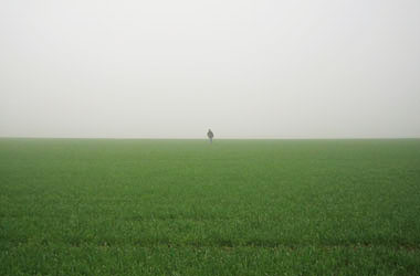
A Semacode measuring 160 x 160 meters was mown into a wheat field near the town of Ilmenau in the Land Thuringia.
The code consists of 18 x 18 bright and dark squares producing decoded the phrase “Hello, world!”.
The project was realized in May 2006 and photographs were taken of it during a picture flight in the following month.
Hello, world!
The phrase “Hello, world!” was born of Brian Kernighan’s idea.
After Kernighan had published his programming manual
“The C Programming Language” in 1978,
it became tradition
- learning a programming language - to write a programme
as a first step,
that produces the “Hello, world!” sequence of characters on the screen. This has been a simple
exercise to gain first insights into the syntactical demands of a program-
ming language. “Hello, world!”
thus symbolizes the first moment of acquiring a technology.
Semacode
The Semacode is a visual code that – based on the DataMatrix norm ISO/IEC 16022
– codes character strings. It was planned
to graphically code weblinks.
The thus extracted pixel graphics can for example be retranslated from camera mobiles into URLs.
Machine-readable writings like the Semacode are called visual codes.
There are numerous related norms and just as many ways of using them.
The Deutsche Post uses these codes on parcels and letters to automate distribution,
the railway to sell tickets online.
Principally it is always about linking real objects to digital data stocks.
Visual codes reveal their digital nature in a form perceivable for man thus referring on a visible level to abstract digital mechanisms.
These are the basis for numerous phenomena of our daily routine.
At the same time they are only hardly to decipher for man being machine-readable writings.
With “Hello, world!” the code serves as a kind of branding of a digital culture whose omnipresence is obvious,
yet whose modes of action are unknown in wide parts of society.
Google Earth
Google Earth makes it possible to navigate across a virtual image of Earth.
The developers themselves describe the programme as “a 3D interface to the planet”.
Unlike a simple map-programme this programme tries its hand at a detailed 3D-depiction of Earth
and uses an illusion of flying as a means of moving between selected places.
A feeling between acquisition and control is produced in the perception of the user on the one
hand and a feeling between supervision and being at the mercy of something or someone on the other hand.
Thus the programme refers to a fundamental problem of modern media and technologies and focuses their
ambivalence between potentiality and thread in one feeling. Google Earth itself cannot really honour
any of these sides, neither flying nor supervision are possible in the end. Alone the visual power of
the user’s experience shows beyond the programme. Google Earth wants to depict the world more or
less objectively; looking back on historical map you will notice that these often tell more about the epoch,
that has produced them, than about the actual composition of Earth.